
 Search
 Feedback
 About
About Help
Help News
News
| Listing 1 - 10 of 11 | << page >> |
Sort by
|

ISBN: 0080423434 0080423442 0750627026 Year: 1996 Publisher: Enschede Oxford International Cartographic Association Butterworth-Heinemann
Abstract | Keywords | Export | Availability | Bookmark
 Loading...
Choose an application
- Reference Manager
- EndNote
- RefWorks (Direct export to RefWorks)
Use of new systems means that the traditional methodologies have to be augmented with new skills, and as a result the fundamental nature of the profession is changing. Volume 3 of 'Basic Cartography for students and technicians' has been prepared to provide information on, and illustration of, the evolving technologies now providing cartographers with new methods for the visualisation and communication of spatial information to a growing, increasingly map-hungry, and ever more knowledgeable international audience.
Cartography. --- Basic Sciences. Geography --- Geography (General) --- Geography (General). --- Cartography --- Cartography, Primitive --- Chartography --- Map-making --- Mapmaking --- Mapping (Cartography) --- Mathematical geography --- Surveying --- Map projection --- Maps
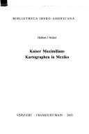
ISSN: 00678015 ISBN: 3893545964 Year: 1996 Publisher: Madrid Frankfurt am Main Iberoamericana Vervuert
Abstract | Keywords | Export | Availability | Bookmark
Loading...Choose an application
- Reference Manager
- EndNote
- RefWorks (Direct export to RefWorks)
Geographers. Cartographers --- Maximilian [Emperor of Mexico] --- Cartography --- Cartography, Primitive --- Chartography --- Map-making --- Mapmaking --- Mapping (Cartography) --- Mathematical geography --- Surveying --- Map projection --- Maps --- History
Book
Abstract | Keywords | Export | Availability | Bookmark
Loading...Choose an application
- Reference Manager
- EndNote
- RefWorks (Direct export to RefWorks)
Praktisch tot 1800 lieten de kaarten niet alleen het geografisch beeld van een gebied, met steden en dorpen, wegen en wateren zien, maar ook sierelementen, sierschrift en sierranden met wapens, klederdrachten, stadsgezichten en wat al meer. In dit boek zijn een aantal belangrijke voorbeelden van de 17de-eeuwse kaartversiering bijeengebracht waaruit het grafisch kunnen van de oude cartografen spreekt. Een aantal elementen keert herhaaldelijk terug, in de eerste plaats de 'cartouche' die uit de zestiende eeuw is overgenomen en oorspronkelijk als sierelement in de bouwkunst fungeerde (Frans Floris de Vriendt, Hans Vredeman de Vries). Ook voorstellingen uit de klassieke mythologie komen vaak voor, evenals populaire symbolische of allegorische figuren, zoals de 'wildeman'. In de zeventiende eeuw treedt ook het landschap als versieringselement naar voren.
Book history --- 912 <492/493> --- 912 "16" --- 655.3.026 --- Cartografie. Kaarten. Plattegronden. Atlassen--?<492/493> --- Cartografie. Kaarten. Plattegronden. Atlassen--17e eeuw. Periode 1600-1699 --- Drukken van specifiek drukwerk. Drukken van kranten, postzegels, kaarten, commercieel drukwerk --- Cartography --- Cartouches, Ornamental (Decorative arts) --- Ornamental cartouches (Decorative arts) --- Decoration and ornament --- Emblems --- Cartography, Primitive --- Chartography --- Map-making --- Mapmaking --- Mapping (Cartography) --- Mathematical geography --- Surveying --- Map projection --- Maps
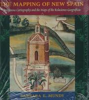
ISBN: 0226550966 Year: 1996 Publisher: Chicago London University of Chicago Press
Abstract | Keywords | Export | Availability | Bookmark
Loading...Choose an application
- Reference Manager
- EndNote
- RefWorks (Direct export to RefWorks)
Aztec cartography --- Cartography --- Indian cartography --- History. --- 528.9 --- Cartography. Mapping (textual documents) --- 528.9 Cartography. Mapping (textual documents) --- Cartography, Indian --- Indians --- Cartography, Primitive --- Chartography --- Map-making --- Mapmaking --- Mapping (Cartography) --- Mathematical geography --- Surveying --- Map projection --- Maps --- Aztecs --- Cartography, Aztec --- History --- Mexico --- New Spain --- Cartography - Mexico - History. --- Cartography - New Spain - History. --- Indian cartography - New Spain - History. --- Aztec cartography - History.
Periodical
ISSN: 14134853 19822170 Year: 1996 Publisher: Curitiba, PR : Universidade Federal do Paraná, Curso de Pós-Graduação em Ciências Geodésicas
Abstract | Keywords | Export | Availability | Bookmark
Loading...Choose an application
- Reference Manager
- EndNote
- RefWorks (Direct export to RefWorks)
Geodesy --- Géodésie --- Periodicals. --- Périodiques --- Photogrammetry --- Remote sensing --- Physics --- Astronomy --- photogrammetry --- geodesy --- cartography --- remote sensing --- geographic information systems --- Geodesy. --- Photogrammetry. --- Remote sensing. --- Remote-sensing imagery --- Remote sensing systems --- Remote terrain sensing --- Sensing, Remote --- Terrain sensing, Remote --- Aerial photogrammetry --- Aerospace telemetry --- Detectors --- Space optics --- Photographic measurements --- Stereophotogrammetry --- Degrees of latitude and longitude --- Geodetics --- Geophysics --- Geomatics --- Mathematical geography --- Surveying --- Image analysis --- Geodesy. Cartography --- Geography
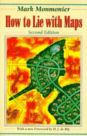
ISBN: 0226534200 0226534219 Year: 1996 Publisher: Chicago (Ill.) University of Chicago Press
Abstract | Keywords | Export | Availability | Bookmark
Loading...Choose an application
- Reference Manager
- EndNote
- RefWorks (Direct export to RefWorks)
Originally published to wide acclaim, this illustrated essay on the use and abuse of maps teaches us how to evaluate maps critically and promotes a healthy skepticism about these easy-to-manipulate models of reality. To show how maps distort, Monmonier introduces basic principles of mapmaking, gives entertaining examples of the misuse of maps in situations from zoning disputes to census reports, and covers all the typical kinds of distortions from deliberate oversimplifications to the misleading use of color.
Cartography. --- Deception. --- Geodesy. Cartography --- Maps --- Cartography --- Deception --- Cartes --- Cartographie --- Tromperie --- Analysis --- Analyse --- Aardrijkskunde --- Manipulatie --- Beïnvloeding --- Cartografie --- 528.22 --- 528.9 --- 528.22 Methods of determining the figure of the Earth --- Methods of determining the figure of the Earth --- Chicanery --- Deceit --- Subterfuge --- Truthfulness and falsehood --- Intrigue --- 528.9 Cartography. Mapping (textual documents) --- Cartography. Mapping (textual documents) --- Cartography, Primitive --- Chartography --- Map-making --- Mapmaking --- Mapping (Cartography) --- Mathematical geography --- Surveying --- Map projection
Abstract | Keywords | Export | Availability | Bookmark
Loading...Choose an application
- Reference Manager
- EndNote
- RefWorks (Direct export to RefWorks)
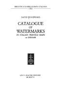
Cartography --- Watermarks --- History --- 09:676 <45> --- 745.543 --- 912 <09> <45> --- -Watermarks --- -Filigrains --- Marks in paper --- Water-marks --- Marks of origin --- Cartography, Primitive --- Chartography --- Map-making --- Mapmaking --- Mapping (Cartography) --- Mathematical geography --- Surveying --- Map projection --- Maps --- Handschriften en oude drukken: papier, watermerken--Italië --- Watermerken --- Cartografie. Kaarten. Plattegronden. Atlassen--Geschiedenis van ...--Italië --- -History --- -09:676 <45> --- -Handschriften en oude drukken: papier, watermerken--Italië --- -09:676 <45> Handschriften en oude drukken: papier, watermerken--Italië --- Filigrains --- 745.543 Watermerken --- -745.543 Watermerken --- 09:676 <45> Handschriften en oude drukken: papier, watermerken--Italië --- -Cartography --- Cartography - Italy - History - 16th century. --- Watermarks - Italy - History - 16th century.
ISBN: 9061943086 Year: 1996 Publisher: 't Goy, The Netherlands HES Publishers BV
Abstract | Keywords | Export | Availability | Bookmark
Loading...Choose an application
- Reference Manager
- EndNote
- RefWorks (Direct export to RefWorks)
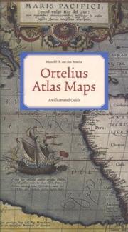
This book is a guide that provides information on the occurrence of each map in various atlas editions, thus allowing the reader to determine from which edition a loose map derives. It also provides information on the various states that most maps went through, and gives their cartographical sources. Many new maps have been identified by the author, and are described here for the first time.
Geodesy. Cartography --- Ortelius, Abraham --- Intercontinental regions --- Ortelius Abraham. Theatrum Orbis Terrarum --- 912 <09> <493> --- 912 "15" --- 912 <100> --- 094 ORTELIUS, ABRAHAM --- Cartografie. Kaarten. Plattegronden. Atlassen--Geschiedenis van ...--België --- Cartografie. Kaarten. Plattegronden. Atlassen--16e eeuw. Periode 1500-1599 --- Cartografie. Kaarten. Plattegronden. Atlassen--Wereld. Internationaal. Alle landen gezamenlijk --- Oude en merkwaardige drukken. Kostbare en zeldzame boeken. Preciosa en rariora--ORTELIUS, ABRAHAM --- Geografie --- Atlases --- Atlases, Dutch --- Cartography --- Cartografie --- Historische Cartografie. --- Ortelius, Abraham, --- Catalogs. --- 094 ORTELIUS, ABRAHAM Oude en merkwaardige drukken. Kostbare en zeldzame boeken. Preciosa en rariora--ORTELIUS, ABRAHAM --- atlases --- cartography [discipline] --- Cartography, Primitive --- Chartography --- Map-making --- Mapmaking --- Mapping (Cartography) --- Mathematical geography --- Surveying --- Map projection --- Maps --- Dutch atlases --- Early works to 1800 --- Belgium --- History --- Llwyd, Humphrey, --- Ortel, Abraham, --- Oertel, Abraham, --- Ortels, Abraham, --- Ortelio, Abramo, --- Ortelius, Abrahamus, --- Hortel, Abraham, --- Ortell, Abraham, --- Wortels, Abraham, --- Bartolus, --- Ortelio, Abraamo, --- Bartolus, Abraham, --- Bartholus Arameis, Abraham, --- Ortelius, A. --- Orthellius, Abraham, --- Ortellio, Abram, --- Mercator, Gerhard, --- Hoefnagel, Joris, --- Plantin, Christophe, --- Camden, William, --- Meteren, Emmanuel van, --- Philip
Book

ISBN: 8876632107 9788876632105 Year: 1996 Volume: 4 Publisher: Urbania Edizioni Biblioteca e Civico Museo di Urbania
Abstract | Keywords | Export | Availability | Bookmark
Loading...Choose an application
- Reference Manager
- EndNote
- RefWorks (Direct export to RefWorks)
Mercator, Gerard
---
Cartography
---
History
---
Exhibitions.
---
912 <09> <493>
---
094 MERCATOR, GERARDUS
---
094.2 <45 URBANIA>
---
-Cartography, Primitive
---
Chartography
---
Map-making
---
Mapmaking
---
Mapping (Cartography)
---
Mathematical geography
---
Surveying
---
Map projection
---
Maps
---
Cartografie. Kaarten. Plattegronden. Atlassen--Geschiedenis van ...--België
---
Oude en merkwaardige drukken. Kostbare en zeldzame boeken. Preciosa en rariora--MERCATOR, GERARDUS
---
Oude drukken: bibliotheekcatalogi--

ISBN: 019727501X Year: 1996 Publisher: Oxford Oxford university press
Abstract | Keywords | Export | Availability | Bookmark
Loading...Choose an application
- Reference Manager
- EndNote
- RefWorks (Direct export to RefWorks)
Atlases, Turkish --- Cartographers --- Cartography --- Cartography. --- Turkey. --- Early works to 1800. --- History --- Pirî Reis, --- Nasser D. Khalili Collection of Islamic Art. Manuscript. MSS718. --- Geodesy. Cartography --- Piri Reïs, Moehji al-din --- 912 <09> <560> --- 912 "15" --- 912 <4-015> --- 912 <26> --- 912:551.46 --- -Cartographers --- -Cartography --- -Cartography, Primitive --- Chartography --- Map-making --- Mapmaking --- Mapping (Cartography) --- Mathematical geography --- Surveying --- Map projection --- Mapmakers --- Earth scientists --- Turkish atlases --- Cartografie. Kaarten. Plattegronden. Atlassen--Geschiedenis van ...--Turkije --- Cartografie. Kaarten. Plattegronden. Atlassen--16e eeuw. Periode 1500-1599 --- Cartografie. Kaarten. Plattegronden. Atlassen--Middellandse-Zeegebied --- Cartografie. Kaarten. Plattegronden. Atlassen--Oceanen. Zeeën. Zeestraten en zeeverbindingen --- Kaarten. Atlassen: oceanen --- Piri Reis --- -Cartografie. Kaarten. Plattegronden. Atlassen--Geschiedenis van ...--Turkije --- 912:551.46 Kaarten. Atlassen: oceanen --- -912:551.46 Kaarten. Atlassen: oceanen --- Cartography, Primitive --- Maps --- Pirı̂ Reis, --- Ahmet Muhiddin Piri, --- Pı̄rı̄ Muḥyi ʼl-Dīn Reʼis, --- Pirî, --- Pirî Reis,
| Listing 1 - 10 of 11 | << page >> |
Sort by
|